Richard and Suzanne and Duncan's Big 2014 Road Trip
Stage 1 - Shooting the Plains
Phoenix, AZ to Minneapolis, MN
Note: Clicking on any of the pictures will bring up a larger version, in a click-thru album for that day. Enjoy!
Day 1 - Friday, June 20, 2014
Phoenix, AZ to Holbrook, AZ
185 miles
Another Big Road Trip is upon us! Are we ready? No. But we're going anyway.
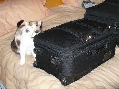
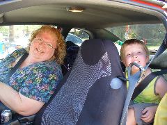
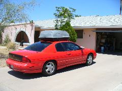
We packed and prepared under the close supervision of the kittycats, and had Suzanne's bright red Monte Carlo (and the firmly-strapped-on cartop carrier) stuffed full of essential items and three humans nearly on schedule. After a brief family visit, we chose to take state route 87 (known locally as the "Beeline Highway") in the belief that on this nearly-110 degree day, the non-freeway option might be a bit easier on our car than the freeway. However, although Monte's 3.4 liter aluminum-block engine was up to the task of handling the heavy load, steep grades, and intense heat, the cooling system wasn't as happy, and a few very steep uphills were hot indeed as we used all available means to keep the temperature gauge out of the zone of expensive unhappiness.
|
|
|
Nova 'helps' us pack
|
Ready to roll again!
|
|
|
|
Rolling out of the driveway
|
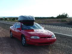
Out on the open road!
|
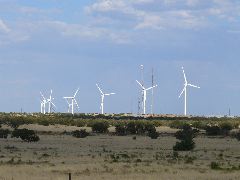
After such a sweaty start, we were relieved to see the pines of Payson, and a stop at the Dairy Queen to chill out with a Dilly Bar and other items was well-advised. More climbing up the scenic cliffs of the Mogollon Rim awaited us, but the dry 80-degree air was much more acceptable to both the vehicle and its occupants, and over the crest and into the forests we continued without incident. Today we had no time to regard Overgaard, though, and diagonally we zoomed along the narrow track of state highway 377, seeing the white blades of the new windmills whoosh under the puffy white clouds.
|
|
|
|
Having a Dilly "Bar" of a good time in Payson
|
New windmills spin on the plateau
|
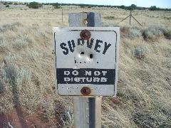
Slightly-perforated witness post from the old Arizona Highway Department days
|
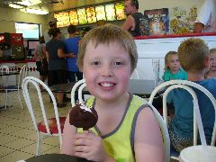
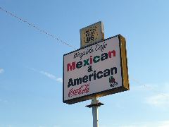
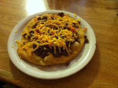
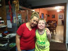
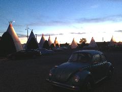
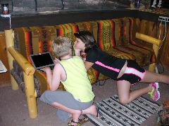
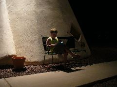
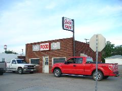
Then over the Little Colorado River bridge and the busy BNSF rail tracks, a turn left at the corner of Route 66 and Route 66, and the Wayside Cafe awaited us on the west edge of Holbrook. Peewee Maestas and her staff were bustling around the tables serving old and new friends, but not so busy that they couldn't exchange some big hugs with us and swap stories about family and events (has it really been a year since we saw each other?) And once our great green-chile meal was complete, we motored a few blocks east to the conical congregation of the Wigwam Village Motel, and settled in for a stay. And once the sun descended, the stars and moon emerged, and everything was settled and stowed, Duncan sat outside our cozy cone, his face illuminated by the glow of the screen as he hunted the wireless signal to check on his many little electronic Minecraft friends.
|
|
|
A sign of good eats on Route 66
|
Frybread yumminess served up hot by Peewee and family
|

|
|
|
"Do I have onion breath?"
|
Great to see Peewee again
|
|
|
|
|
Wigwams in the twilight
|
Showing his Minecraft stuff to a fellow young traveler
|
Catching up with all his little electronic friends outside the cozy cone
|
Day 2 - Saturday, June 21, 2014
Holbrook, AZ to Tucumcari, New Mexico
418 miles
A crazy boy bouncing on the Wigwam beds is one way to start our first full road trip day. If nothing else, it does serve as a very effective wake-up device. And once we got our boy bouncing out the door to create a detailed chalk-drawn diorama on the surrounding sidewalk, onto the smiling dinosaur for the obligatory photo (is that dino getting smaller every year?) and into the fully-laden car, it was definitely time for breakfast.

|

|
|
White Wigwams in the Arizona sunshine
|
Bug in the window
|

|

|

|
|
Chalkin' away
|
A big blue two-dimensional epic
|
Saddle time on the Wigwam dino
|
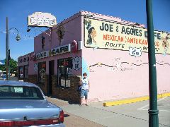
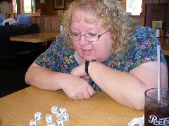
And just down the street, at Joe and Aggies, they do indeed serve good meals with a smile, and we chowed down on grilled ham, frybread, and beans amid the legendary decor and friendly folks, while the story cubes were deployed for intra-meal entertainment.
|
|
|
Time for a legendary Route 66 breakfast
|
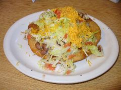
There is no rule that says you can't have Navajo tacos twice in a row. Especially on a road trip.
|
|
|
|
Suz spins a saga from the Story Cubes
|
Oh, if you insist...
|
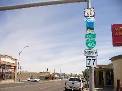
Then out the door to resume our journey, where the tall "totem pole" of reflective signs recognized the overlay of state highway, business routes, and historic byway designations on the roadway leading us onward.
|
|
Needs more signs.
|
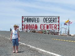
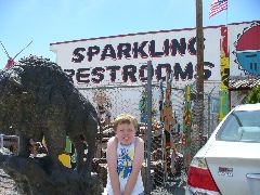
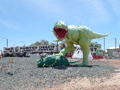
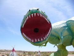
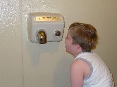
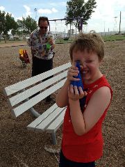
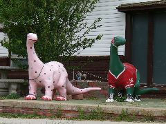
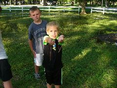
Hey, who's ready for more green grinning dinosaurs? The Painted Desert Indian Center, on a short stretch of old 66 east of Holbrook, has giant dinos and more. Duncan tested the "Sparkling Restrooms", complete with appropriately-decorated tiles depicting Sitting Bull in full regalia, and found them most satisfactory.
|
|
|
|
Time for tourist traps!
|
We think someone really wants to visit a "sparkling restroom"
|
Ferocious green dino defends his concrete kill
|
|
|
|
|
Smile!
|
"Hand over the souvenirs and nobody gets hurt."
|
Selecting the perfect piece of petrified
|
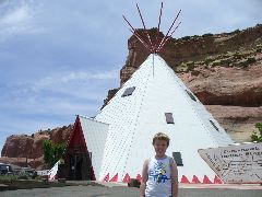
Lupton is on the very eastern edge of Arizona, and at the final exit within our fair state there's a big white metal tepee under the layered red cliffs, and even though it's only a few feet from the state's edge it's chock-full of Arizona-themed items and souvenirs - including a few that we hadn't seen before, which made their way into the car's cubbyholes for future enjoyment.
|
|
|
Big tepee on the state line chock-full of cool stuff
|
Goofy faces in the convex chrome
|
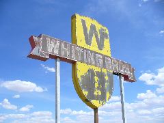
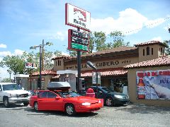
Entering New Mexico, we continued our cruise, driving past the numerous pueblo towns with old tires festooning the roofs, and blue skies arched above while the Moody Blues played on the stereo. Near San Fidel, there's an old yellow relic of the once-expansive Whiting Brothers empire - a giant weathered sign still displaying its W and B proudly against the New Mexico sky. But that wasn't the main reason why we stopped - a "kinda gotta go bad" request from the back seat was the primary incentive to exit. And a short distance down old 66 is the Cubero Trading Post, which seemed like a nice place to satisfy our fueling and personal needs. But the sanitary facilities in Cubero were conked out, which led to a short yet desperate drive to the Sky City complex by the freeway, a place of busy traffic, grumbly people, and long lines - but working facilities.
|
|
|
|
Blue skies, open road, wide state
|
The old Whiting Brothers sign still stands proudly near San Fidel
|
Busy trading post in Cubero
|
Receiving an impromptu 60 mph car wash as a storm smacked Albuquerque, we passed through town on the superhighway, eventually emerging from the weekend construction snarls and threading thru the Sangres to the high plains beyond. Exiting at Moriarty onto the old main street, the cowboy-hatted chicken on the sign for Shorty's BBQ stopped us briefly for a snack, while Richard wandered over to Hart's Hardware next door for a couple indispensable items.
A few miles east of Moriarty, Monte's odometer rolled 65,000 miles, but we had our mind on a place a few miles farther east in Santa Rosa - Park Lake, a scenic body of water perfect for a travel break. Duncan wasted no time in splashing into the water and jumping off the diving board, as his parents stretched out and relaxed on the sandy shore. A few minutes after our arrival, another family piled out of their Kentucky-plated van and jumped into the water, and Duncan did his best to make new friends with them. Turns out they were on a big cross-country road trip as well, traveling westward along 66 to the Grand Canyon and other scenic sites. We compared notes and made suggestions as to good places to see and stop as the kids splooshed and shrieked, and parted ways from the Ballerstedts with heartfelt wishes for safe travels.

|

|

|
|
Colorful craft at Park Lake
|
Big lake for a growing kid
|
Lookoutbelooooww!
|

|
|
|
Showing cool rocks to new friends
|
Where epic road trips collide - meeting the Ballerstedts
|
Even the longest day of the year has to end sometime, and by the time Duncan was dried and tossed back in the car, the sun had retreated and a dark drive awaited us eastward. Although we've stayed several times in Tucumcari in the past, recently we've noted a rift in that town between a few property owners that are making great efforts to promote historic US 66 and their city, and others that seemingly are just trying to keep their businesses afloat in difficult times. Now this might be the case for many towns along 66, but here the disagreements have spilled out into other communications, where motel owners have publicly criticized unhappy patrons on review sites, and an innocuous comment by Richard on a Facebook page brought forth ugly attacks from yet another business owner. But this night, we just wanted a clean basic place to sleep, and we bedded down at the Buckaroo on the west side of town.

|
|
Buckaroo sign shines on Route 66 in the New Mexico night
|
Day 3 - Sunday, June 22, 2014
Tucumcari, NM to Jetmore, KS
412 miles
Our morning began with the laptop serenading us with the "Little Piggy" song from the game of Minecraft. Now the task for the rest of the day will be to get that song OUT of our heads - if it's even possible.
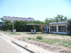
The open road awaited us outside the bronco-festooned door of the Buckaroo. Only this time, we wouldn't be following 66 eastbound - instead, we'll be heading diagonally east by north along US 54, to take a few miles off our journey. Highway 54 gave a smooth fast ride to Nara Visa, where an abandoned Chevron station, with streamlined Bennett gasoline pumps still standing on their concrete islands before the cracking windows of the office and service bays, stood slowly bleaching and rusting in the eastern New Mexico sun.
|
|

|
|
Quiet morning on US 54 in Nara Visa, NM
|
Abandoned service station on US 54 in Nara Visa, NM
|
Gas pumps from the days when prices were in cents per gallon
|
It was about this time that the map started giving us some interesting ideas. We veered off US 54 to take some very quiet back roads north, interrupted by only the occasional antelope sighting on the uncommonly-green plains. In Clayton, we turned onto US 54's parallel pal US 56, and drove this for a few miles until the map, GPS, and other navigation facilities instructed us to turn south for a spell down a dirt road to a survey marker at the edge of a plowed field.
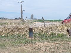
|
|
Survey obelisk marks the spot where three states converge
|
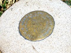
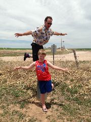
And there it was - the place where New Mexico, Texas, and Oklahoma meet at one point. Contrary to popular belief, the eastern border of New Mexico isn't a completely straight line - there's a 2-mile jog in the boundary where an allegedly "erroneous" survey took a couple miles of territory and gave it to the Texans. And although New Mexico was grumpy about it, the line's been upheld, and that's why this marker shows all TX to the south and NM and OK to the north - with the northwesternmost corner of the whole state of texas a couple fields to the west (only a few feet from US 56, in fact). Being good tourists, we made the obligatory goofy poses on the obelisk, enjoying our three-statedness without the long lines and crowded condition of Four Corners (only a cow eyeing us strangely from a respectful distance).
|
|
|
New Mexico to the northwest, Oklahoma to the northeast, and all Texas to the south
|
Three states for two of the Moeurs
|
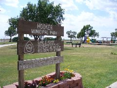
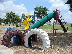
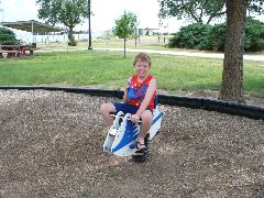
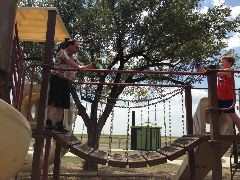
Then back in the car and eastward along the nearly-200-mile-long Oklahoma Panhandle. Rolling around the Boise City 'square-about' brought us to US 64, which took us on an arrow-straight course by ranches and fields, the rippling waves of heat distorting the asphaltic view. We hooked into Hooker by the back roads, and discovered a fun city park that seemed mighty nice for a break, even if the temperature was about 'a hunnert' or so. Duncan and his dad deployed the squirt bottles for a dashing duel around the swings, bridges, and slides, while Suz smartly hid under a shade tree while a big birthday bash for some other lucky kid carried on beside us.
|
|
|
Odd sign for a square roundabout
|
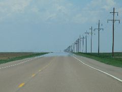
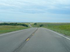
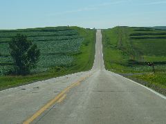
The view for most of the day - long straight stretches of quiet open highway
|
|
|
|
Fun park in the OK Panhandle
|
Many colorful places to play
|
|
|
|
|
Bounce n' squirt
|
"Reach for the sky!"
|
Dunc and Dad duel
|
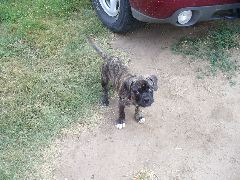
As we returned to the car, we discovered a happy little puppy parked next to our Monte, who seemed very pleased to make our acquaintance. Her owner appeared and introduced us to "Snoopy", and we began the next part of our trip covered in puppy kisses (and a few stray pieces of grass).
|
|
Hello, little Snoopy!
|
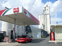
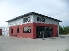
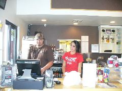
After a brief stop at the Equity Co-op grain elevator for Cenex fuel, we continued east for a piece, but noted a big build-up of gray thunderclouds on the horizon off the Monte's nose. After saying hi to the brightly-painted dinosaurs greeting the traffic passing through Forgan, we turned north on route 23 to try to avoid the storms, and soon found ourselves in Kansas, the fourth state of the day. We'd passed through Meade in the past, but discovered a new eatery on this visit in the Smoke Hoss BBQ, where the sandwiches are big and very meaty, and the staff smiling and friendly (except for the guy in the back, but he seemed decent enough).
|
|
|
Fueling up in the shadow of the grain elevators
|
The goofy dino-buddies of Forgan
|
|
|
|
Smoke Hoss BBQ in Meade
|
Friendly folks at the Smoke Hoss (at least on the right :)
|
Highway 23 (now in a sunflower sign) continued north from Meade, but those dagnabbed storms done caught us and tossed us despite our detour, and the afternoon drive turned into a mess of flooding roads, standing water, and flying debris. Even though there was some daylight remaining, we reckoned that more miles today might not be all that smart or healthy for us or the car, so we followed 156 into Jetmore and discovered the Pawnee Valley Lodge at the corner of 156 and US 283. Now we're experienced back-road travelers, and understand that a one-motel town can be full of lodging "surprises". Only in this case, behind the modest exterior were very nicely-appointed rooms, but with appropriately higher prices to match (and if we didn't register right quick, the harvest crews roaming the area bringing in the early wheat crop will grab all the remaining rooms anyway). And so we relaxed and hid away from the thunder in the Pawnee Valley's comfort, and plotted our plans for a longer day tomorrow.
Day 4 - Monday, June 23, 2014
Jetmore, KS to Mapleton, IA
481 miles
The Pawnee Valley Lodge's beds were almost too comfy to roll out of, but we knew that the previous delays would mean many long miles ahead. Richard was 'volunteered' to find a tasty small-town breakfast, which was located at Judy's Cafe, just south of the motel on the brick-paved streets of US highway 283. Just after opening time, Richard walked in the door next to the Dr. Ben Carson posters and tractor repair ads, and saw that the place was already very full of very hungry local folks. He ordered up some ham, eggs, and other hearty items, and listened in as the farmers commented on how the recent heavy rains would've been a bit better had they come earlier in the wheat season, instead of right at harvest time - but at least the rain will do wonders for the corn - as long as it doesn't flood the fields, that is. The towering piles of Styrofoam-packed food were transported back to the room and eagerly received, and then time to pack up and resume our travel on a slightly-drier day.
|
|
|
The brick-paved main street of Jetmore
|
Good eats at Judy's Cafe
|
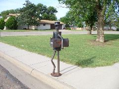
We jetted north out of Jetmore on US 283, making good time over the distances between the widely-spaced towns of the western Kansas prairie. One thing we did distinctly notice about these Kansas towns: every so often, we'd see mailbox and supports that exhibited a high degree of humor and cleverness, such as the jaunty metal man in Ness City holding his mailbox under his crooked pipe-forged elbow, or the gun-wielding metallic desperado keeping his box safe from mail thieves and other varmints in Hill City (Home of the Ringnecks!)
|
|

|
|
US 283 rolls north
|
Metal dude handles mail duty in Ness City
|
But Hill City's mailbox man is much better-armed
|
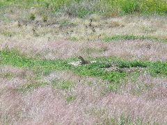
Near the top of Kansas on US 283, the town of Norton contains the Museum of Presidential Also-Rans, and even though we're from Arizona (from whence Goldwater and McCain conducted their doomed campaigns), we decided instead to visit a fuzzier destination in the area - the aptly-named Prairie Dog State Park. After paying the modest $5 entry fee and ogling the exhibits in the main building, we drove out to the sprawling metropolis of rodentia to watch the little chubbies pop up and down and scurry to and fro in their endearingly funny way, while attempting to get at least one or two non-blurry photos as they'd floop out of sight just as the shutter was pressed.

|
|
|
|
Time for fuzzy-ogling!
|
"What do you see?" "Just some goofy tourists."
|
Popping in and out of their little hidey-holes
|
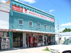
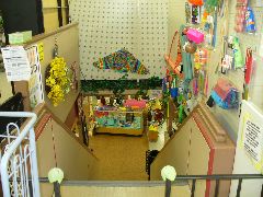
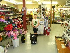
After noodling past the Nebraska welcome signs, we crossed the Republican River (flowing to the right, as well it should) and approached the town of Arapahoe. We discovered a two-story store in this town by the name of Wagner's, with a well-stocked grocery store on the ground floor, where we obtained the yummies we'd need for the upcoming week. But there, in the middle of the store - where does that staircase lead downward to? Why there's an even-better-stocked variety store in the basement right under the groceries, and here Suzanne loaded up on balls of yarn in colors she'd never yet seen back in Phoenix, while Duncan ogled the toys and had great fun steering the low-slung wheeled baskets around the aisles.
|
|
|
|
A great stop in Arapahoe
|
Stairway to fun stuff below
|
Our little helper amid the yarn, garden tools, and sundries
|
After creatively stowing our acquisitions ("Duncan, just don't let it topple over on you back there"), we looped thru the local streets (hey, Arapahoe has a nice park - we'll have to remember that for next time), and turned east on US highway 6. As we headed through Holdredge, we spied a Taco John's by the roadside, which brought back many memories for Suzanne from her days in Michigan and Minnesota, and a pile of tacos and other semi-spicy items joined us in the car. After a spell of 2-lane driving on 6, we arrived in Hastings, toured the picturesque downtown, and reloaded on dino-fuel and brain-freezing super-size sno-cones.
|
|
|
We stop for frozen fun in Hastings
|
"I don't get brain freezes. But I do get tongue freezes!"
|
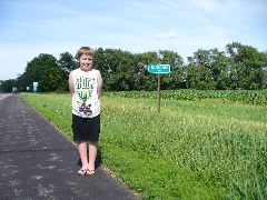
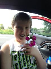
We departed northward on the Tom Osborne Expressway, trying to dodge the bumpers, fragrances, and occasional byproducts of the numerous cattle trucks blocking our way and blitzing through our path. At Grand Island, we hung a right on US 30 (also known as the Lincoln Highway, which just celebrated its centennial) for a busy afternoon drive beside the hooting freight trains and numerous bright red Ns denoting the adherents of the Husker faith. And along this highway there just happens to be a small town named Duncan, so of course our son had to hop out and get his photo with the official green signs displaying his name. And while he was out of the car, he discovered some pretty purple wildflowers which he presented to show his love to his mom (hey, she hadn't yelled at him for at least 20 miles. OK, maybe 15).
|
|
|
Duncan visits another Duncan - this time on the Lincoln Highway
|
Flower surprise for Mom
|
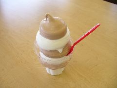
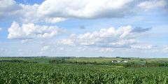
Speaking of discoveries: in Columbus we found a Dairy Queen to provide us some appropriately-decadent nutrition, and marveled at the staff's abilities to take a lowly two-flavor soft-serve cone and make into a work of art worthy of acclaim (or at least eager eating). And then into the car for some zigging and zagging up Nebraska state highways with their distinctive covered wagon route marker design, enjoying the view of the undulating fields of corn and other crops stretching to the horizon.
|
|
|
A true work of modern art. Yummy, too.
|
Scenic rolling hills of northeast Nebraska
|
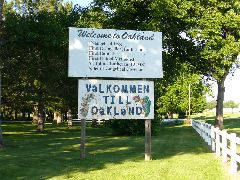
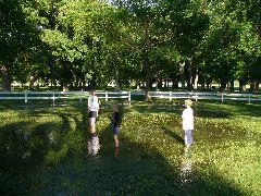
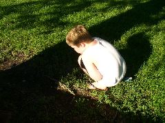
It had been a while since that DQ in Columbus, and a break seemed welcome as we approached Oakland. On the west side of town, the city park looked most inviting, and the aroma of hot dogs and popcorn emanating from the snack bar by the ball fields made for an even-more-enticing stop. But when Duncan started to make his way toward the play area, he was intercepted by a gaggle of local kids who made him an offer that no 9-year-old boy could refuse: "We're going on a worm hunt! Want to come along?" It turned out that recent flooding had turned some of the grassy fields into mucky marshes; however, this meant that conditions for finding, yanking, and playing with slimy earthworms and squirmy nightcrawlers couldn't have been better. Duncan eagerly joined the others in splashing and sifting through the moist wet soil, and soon had several new elongated friends squiggling up his arms and elbows. He named one of them "Mr. Wormy", and commiserated with him for quite a while before carefully placing him back on the ground to resume his subterranean existence hopefully free from hungry robins or raging rototillers.
|
|
|
|
Ve feel valcomed
|
Kid heaven - worm-hunting on a sunny afternoon
|
"Wanna see my worms, mister?"
|

|
|
|
|
"I found one! I'll call him 'Wormy'."
|
Wormy re-enters his mulchy habitat
|
Bye bye, Wormy!
|
Scrub off, back in the car, and head toward the Missouri River and our next state. Duncan's pronouncement regarding the Oakland worm-o-rama: "That was the very best part of the whole road trip." And so it was.
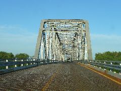
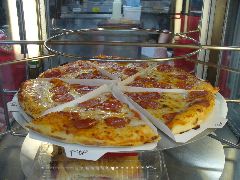
After taking a very swoopy loopy back road, we crossed the flood-swollen Missouri River on the steel truss bridge between Decatur and Onawa, with our wallets pleased by the sight of the empty toll booths. More driving along the Loess Hills Scenic Byway with the late-day sun in the side windows brought us to the picturesque little town of Mapleton, where the Maple Motel nestles in the curve in the highway near the north junction. Alas, the on-site restaurant was no longer in business, and the other local eateries were also shut for the night - but fortunately the BP station right across the street had piping-hot pizza ready on its rotating racks,which made for a fine and inexpensive meal as the sun disappeared beyond the spreading trees, and the fireflies came out to illuminate the green lawns outside our motel door.
|
|
|
|
Over the swollen Missouri
|
Sunset view through the Mapleton maples
|
Conked out at the Maple Motel
|
Day 5 - Tuesday, June 24, 2014
Mapleton, IA to Bloomington, MN
302 miles in Monte, 60 or so in motorcoach
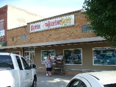
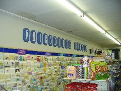
After a sound rest, we mustered out of the Maple Motel and moseyed into downtown Mapleton to begin the day with a visit to the Hometown Variety store to see what their shelves have in store. As you probably already know, we have a strong affinity for small-town stores full of inexpensive eclectic merchandise run by local folks, and this place fit the bill exactly. The basket filled with oddly-shaped pill dispensers, brightly-colored spare board game pieces, skeins of unique yarn for Suzanne's traveling crochet projects, and even some spare sporting goods items, while Duncan gave a most exhaustive recitation of the road trip, his school life, Minecraft, and much else to a sweetly patient clerk and other incidental customers.
|
|
|
|
Great little variety store in downtown Mapleton
|
"Friendship Center". Yes, yes it is.
|
Nice folks here at the Mapleton Variety
|
After Dunc's epic soliloquy concluded, they kindly wished us successful travel, and we turned northeast on route 175 with an expectation of uninterrupted driving.
But that was not to be. Bridges were out between us and Ida Grove, and we were detoured onto a stretch of D-series roads owned by three-letter counties. The good part is what these roads lacked in speed and directness they more than made up for in scenery as they followed the rolling contours of the northwest Iowa landscape, as chubby little prairie dogs scurried across our path from one green shoulder to the other.
|
|
Detouring through the Ida County cornfields
|
Rejoined larger highways again and soon found ourselves on US 71, a US highway that has played a major role in the national system. In fact, the town of Early proudly calls itself the "Crossroads of the Nation" as it sits at the junction of US 71 and coast-to-coast US 20, and even though the newly-built US 20 freeway bypasses the main part of town, the folks are friendly as we loaded up on an "early" lunch and snacks for the final miles to our destination. Left Early later than expected, but we made good time up to the strip malls of Spencer, where the irresistible combination of a tool warehouse and surplus store dragged Richard one way while the next-door bakery outlet drew Suzanne and Duncan in a sweeter direction.

|
|

|
|
Goofing around in Early
|
Mmmmm. Casey's Pizza.
|
Even the burger is smiling
|
From here, there are two routes around the vacation mecca of Lake Okoboji, and we chose the west side as we motored by the vacation cabins and resort facilities. Then on across the border into Minnesota around high noon, and a merge on the route 60 expressway for an expected quick drive across the lake-laced prairie.
Nope - more bridge-related detours. At St. Peter, the orange drums pushed us off the expressway and onto additional winding county roads, as Richard checked his watch in the remembrance of later-day deadlines. And at Mankato, we veered north on US 169, expecting a fast and scenic drive toward the Twin Cities. But given our previous luck, what would you expect to happen?
The recent news reports for the upper Midwest had described the unseasonably heavy rains across the region, and weather reports noted that some flooding was possible. But as the waters from the overflowing Minnesota River began to lap across the travel lanes of 169, we resigned ourselves to a future of more circuitous detours, which came soon enough as the highway disappeared under blue waters behind orange barricades.
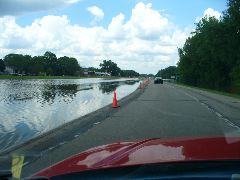
|
|
Overflowing Minnesota River getting a bit too friendly with US 169
|
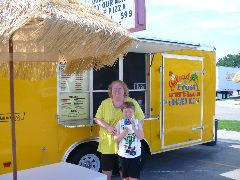
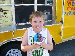
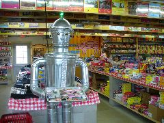
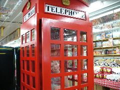
OK, we're getting sorta close to the big cities, and we're somewhat behind schedule. Let's not stop for anything - oh, wait, what's that up ahead? The mass of Minnesota's Largest Candy Store loomed like a gigantic screaming yellow jelly bean on our left, and we had no choice but to make one more stop. The interior of this enormous emporium of sugar products was filled with an astonishing variety of products from near and far, and we could have spent hours browsing the walls of jujubees, jackpots of chocolate coins, near-endless jigsaw puzzles, and the World's Largest Selection of Root Beer. But we had places to be, so we escaped with an investment in candy coin, some taffy pulled from the overflowing shelves, and a bottle of Martian Soda (wonder what the interplanetary tariffs are these days?) for Duncan's future enjoyment.

|
|
|
|
Must. Stop. At. Big. Yellow. Barn.
|
Preferred by most Minnesota robots.
|
"Hello - can I order a zillion pieces of candy?"
|
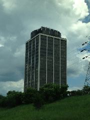
Now we must move, and quickly. After negotiating the unorthodox geometry of the divided highway entrance (don't tell anyone about the U-turn...), we zoomed up the highway into the Twin Cities area, passing the soggy environs of Shakopee and becoming tangled in heavy traffic on the 494 beltway. We passed under the shadow of the tall office building in which Suzanne began her post-college career over 25 years ago, and the GPS alerted us that our final destination for this leg was nigh. Avoid the wacky weaving at the 77 interchange, veer over for the exit, right and right again, and we were in the parking lot of the Ramada Bloomington, our home away from home for the next 5+ days.
|
|
Suzanne's old office building looms above I-494
|
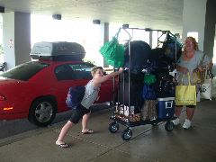
The desk clerk check us in expeditiously, and then advised us that the good news was that the hotel only has two floors so everything's mostly on that level, but added that the not-so-good news is our room was nearly 1/8 mile on the other side of the complex. We commandeered a cart and unloaded the Monte, and trudged the seemingly-endless corridors until our room number finally appeared in the back 40. Finished up unloading with the help of a friend (thanks, Joe Stafford!), and glanced at the clock to see we only had a few short minutes before we were expected downstairs for the scheduled function.
|
|
Hauling our stuff into the Ramada
|
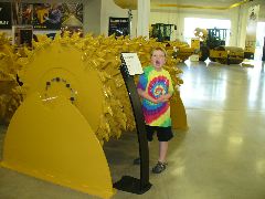
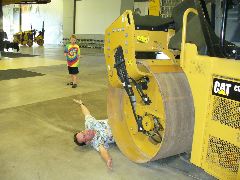
So after a flurry of abbreviated freshening, we emerged downstairs for the motorcoach ride to the evening social function up in Maple Grove, in the far northwest edge of the metropolis. Due to a slight error in head-counting, Richard had to stand for the outbound trip, which did give him a better view of the busy airport and bustling freeways, while Duncan talked the ear off the nearby traffic engineering folks about his trip, video games and other silly streams of consciousness. And after some bonus miles and a few odd turns, we found ourselves at the Caterpillar Paving Products showroom for the evening reception, where appetizers were served amid the vibratory rollers and rota-mills, and we greeted old and new friends also attending the meetings.

|

|

|
|
Impressive entry for the Paving Products showroom
|
Our crawly-tracked hosts for the evening
|
Socializing amid the heavy equipment
|
|

|
|
|
Those roto-mill teeth are a bit scary
|
"Dad, can we get a paving machine?"
|
Flattening the Dad
|
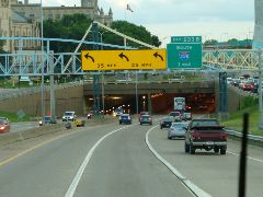
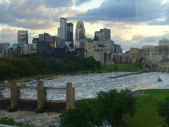
On the way back to Bloomington, the bus driver suggested we tour downtown Minneapolis to see the skyscrapers, stadiums and other new developments, the I-94 tunnel, and the sleek new I-35E bridge spanning the Mississippi River that replaced the one that tragically collapsed several years ago. The river front at sunset with the towers reflecting the late-day rays made for a very scenic sight, and then a vroom back to the room to get a few hours' rest before a very busy week.
|
|
|
Going 'round the bend at the I-94 tunnel
|
Downtown Minneapolis riverfront in the twilight
|
 Back to The Big 2014 Road Trip Page
 Back to Our Big Road Trips Page
 Richard C. Moeur's Home Page
Latest Historical Revisionism 29 December 2014
Scripting: Richard C. Moeur
rcmoeur@aol.com
Coding for photos created by PhotoPage by John A. Vink.
All text and images ©1996-2014 Richard C. Moeur.
All rights reserved. Unauthorized use of text and images is
strictly prohibited. Refer to
Standard Use Agreement
for details.