 |
 |
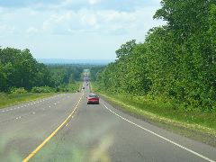 |
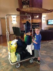
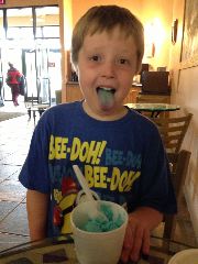
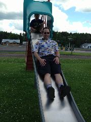
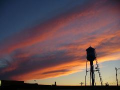
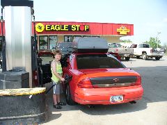
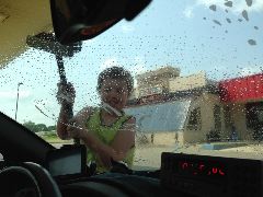
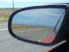
| Hey bellboy! | One more Jilbert's Blue Moon tongue | Back on the open road! |
Note: Clicking on any of the pictures will bring up a larger version, in a click-thru album for that day. Enjoy!
We were planning on staying one additional day up here in the Peninsula, but realized we'd been able to pack a very good time into five days, including seeing and meeting nearly all the friends and relatives (plus a few bonus ones). So after some discussions, consultations with maps, and calculations of mileage, we decided to start heading homeward one day earlier, in the hope this would mean an ability to pack more fun into each day since we wouldn't be compelled to cover as many miles.
Compared to last year's oath-filled ordeal, the Lac Vieux loadout this year went smoothly to the point of being almost pleasant. One more fill-up on complimentary soft drinks at the casino dispensers and low-priced bright blue ice cream at the snack bar, some sincere thanks to the hotel staff for keeping our ice packs freezing (is the Vollwerth's ring bologna in the cooler? yes!), we turned west out of Watersmeet on US highway 2 to commence the long journey back to Arizona.
|
|
|
|
| Hey bellboy! | One more Jilbert's Blue Moon tongue | Back on the open road! |
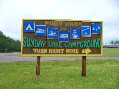
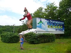
In Wakefield, we refilled the Monte's fuel tank as Richard was amused by the number of service symbols on the sign for Sunday Lake. A bit farther west near Bessemer, near the spot where our truck was almost laid low by an errant deer back in 2006, we stopped at the entry to the Big Powderhorn resort to snap a goofy Duncan-enhanced photo with the titanic ski dude permanently schussing by the highway. And in Ironwood, our paths met up with cousins Dennis and Millie for more relatively good relative contact.
 |
 |
 |
| Needs a few more symbols. | Off season, dude! | Seeing the smiles of Millie and Dennis |
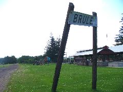
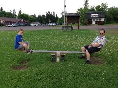
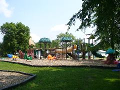
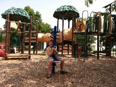
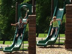
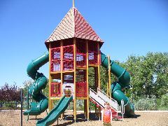
Route 2 enters far north Wisconsin west of here, with the highway traversing broad swaths of woodlands and the swamps of the Bad River. On through Ashland and over to Brule, where a small playground sits by the old railroad grade. This seemed great for a short driving break, with the swings, slides and see-saws providing some low-budget fun.
 |
 |
 |
| Along the abandoned rail line, a playground awaits | We see - and saw again | Shoved down the slide |
 |
 |
| Monkeys on the bars | Unscheduled goofiness |
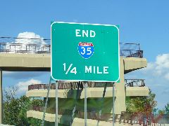
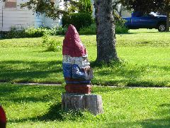
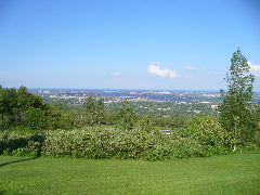
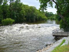
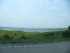
So how much ore can an ore dock dock, if an ore dock could dock ore? The old ore docks in Superior and Duluth at the far western tip of the Great Lakes might be able to tell you - either ore, or coal, or grain, or any other bulk commodity for global trade moves from mile-long trains to 100-foot long bulk carrier ships along these wharves. The wind was starting to blow as we crossed the Blatnik bridge high over the busy harbor, and we were somewhat concerned that the stiff sideways gusts were going to take our cartop carrier (and all that precious junk in it) off the car and plummeting to a watery doom hundreds of feet below. But the straps of the carrier and the nerves of the driver held firm, and we merged onto the Minnesota shore intact. Duluth is also the northern terminus of Interstate Highway 35, a very important trade corridor bisecting the center of the country and linking the north woods with the Twin Cities, Des Moines, Kansas City, Oklahoma City, the Dallas/Fort Work metroplex, and San Antonio, with the other end at the far-flung Mexican frontier at Laredo. We also looped through some very nice residential neighborhoods, and discovered interesting things, including a wood-sculpted lawn gnome much more massive and menacing than those usually encountered in gardens in our travels.
 |
 |
 |
| Getting blasted by crosswinds on the Blatnik Bridge | Welcome to Laredo? | That's Mister Lawn Gnome to you, bucko |
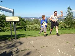
One more Duluth-area stop was in order, to use sanitary facilities and to adjust the attitude of a couple passengers. The Minnesota DOT rest area is on a grassy slope overlooking the lake's end, and was good for an impromptu uphill race between the Dunc and his dad (the kid's keeps getting faster, or Richard's getting older...)
 |
 |
| Duluth with a view | Photo finish |
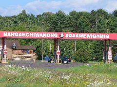
Shall we go south, or west? Let's do west. We cruised the streets of Cloquet, and cut across the Fond Du Lac reservation, where the "Nahgahchiwanong Adaawewigamig" service station made for a tongue-twisting challenge. Then a turn onto state highway 210 (former US 210 and the Dale Wayrynen Highway) for an afternoon cruise along the forests and fields.
 |
 |
| Say that three times fast. Or once. | Get. Off. My. Bumper. |
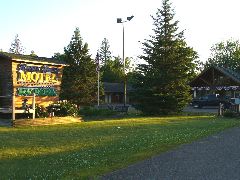
As we arrived in Aitkin (Home of the Gobblers!), we decided to see if this might be a good place to hole up for the night. And on the south edge of this town are the log-cabin walls of the Ripple River Motel (and RV park), where the rooms are clean and comfortable, the pizza and ice cream served up from the front desk is tasty and very convenient - and they're supporters of the Adventure Cycling Association system, being on the transcontinental Northern Tier cycling route. Briefly discussed the possibilities of a new US Bicycle Route following this corridor in the future, and then some photo-wrangling and pizza-pleased rest.
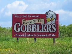 |
| Home of the Gobblers! |
 |
 |
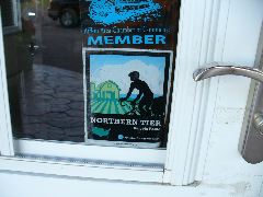 |
| Resting at the Ripple River | Bike-themed planter | And a supporter of the Northern Tier, too |
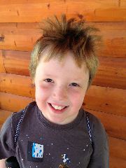
This day started with Richard sneaking out of the room to visit the Aitkin Unclaimed Freight warehouse on the west edge of this Mississippi River town. He's always interested in what unusual and inexpensive items might be found on the shelves and aisles of these eclectic collections of closeout merchandise, and today's haul included many small rolls of colorful tape, bargain lock-back knives, and a couple cans of shiny chrome paint for next year's Pinewood Derby racers. Meanwhile, back at the room, Suzanne was wrestling with Duncan's unruly sleep-disturbed head of hair (and losing), while our son shared statements most, um, profound: "If I could ever have a super-gross superpower of my choice, it would be to be able to burp whenever I want."
 |
| Bed head gone bad |
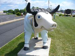
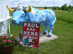
Let's git on 210 west. We weren't sure what to expect of Brainerd, given our recollection of it as an area strongly associated with the legend of Paul Bunyan. What we found was a good average mid-size town but with a noticeably less Bunyanness than we'd been led to believe. Well, it turns out that Paul and Babe had moved east and north toward more-resorty regions, and other than the occasional strip-mall sign, we were left bereft of Bunyans. But the local area did have widely-spread and imaginatively-decorated blue oxen, and we had our picture taken with "Elvis" the ox as he shook his jumpsuited hips in front of a local bank.
 |
| "Thank 'moo' very much." |
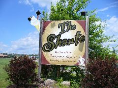
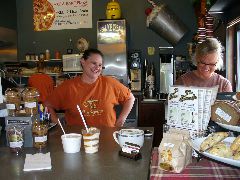
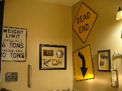
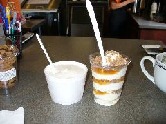
Blowing westward out of Brainerd, we commenced to pillage the village of Pillager, where our marauding crew set forth into the Shante coffeehouse and ice cream shop. Suzanne was very taken by the pretty colored wooden flowers on the walls (and they're for sale? at those prices? yes!), while the boys were very amused by the automotive-themed restroom walls. The attentive and friendly staff whipped up some caramel-laden creamy refreshments, and we returned to the vehicle content with our booty.
 |
 |
 |
| A fine place to pillage in Pillager | A very sweet blue ox | Friendly Shante folks |
 |
 |
 |
| Interesting washroom decor - the W1-2 arrow might be helpful | Nice headlights | Ice cream as an art form |
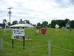
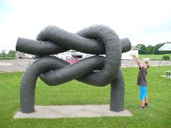
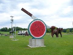
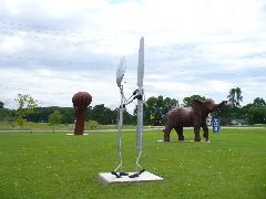
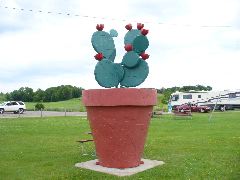
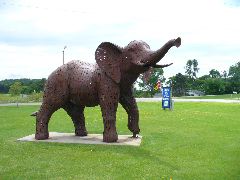
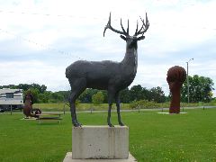
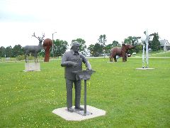
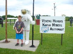
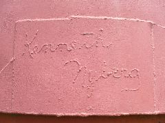
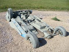
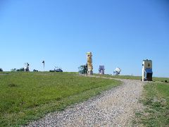
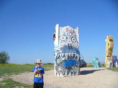
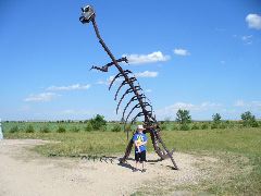
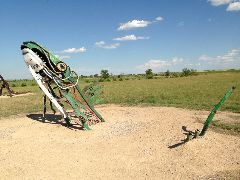
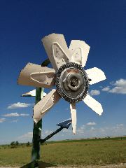
Our motley crew merged onto a mix of traffic on the bumpy thumpy concrete pavement of US 10, and then slipped back onto 210 at Staples, as the adopt-a-highway signs testified to the civic-mindedness of all the Lutheran churches in the area, and some soothing Dvorak played on the Monte's stereo. Several miles hence, near the small burg of Vining, our travel was arrested by the sight of some impressive specimens of metalwork arranged in a park by a cafe and gas station. Turns out that a local resident, a certain Mr. Kenneth Nyberg, has taken up the avocation of creating amazing sculptures out of sheet steel, scrap mower blades, and other metallic items. And it seems that brilliance runs in the family, as Mr. Nyberg's daughter just happens to be a distinguished NASA astronaut with half a year of space travel under her helmet, and one of the metalworks salutes the younger Nyberg and her fellow space explorers.
 |
 |
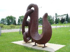 |
| Discovering big things in Vining | A knot big enough for our Cub Scout | A hook for all your Bunyanesque needs |
 |
 |
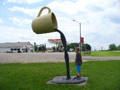 |
| Quite the metal melon | Does the fork know? | Drink up! |
 |
 |
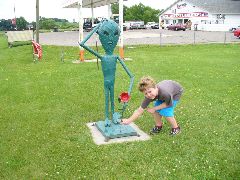 |
| Pliers big enough for almost anything | Quite the prickly | Puzzled alien is puzzled |
 |
 |
 |
| Titanic pachyderm comprised entirely of lawn mower blades | Big buck | Go deep! |
 |
 |
 |
| Mr. Nyberg, by Mr. Nyberg | And mighty proud of his astro-daughter, too | And all signed in arc-welder by the man himself |
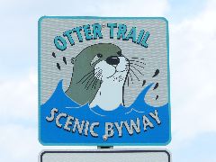
From Vining, we followed the Otter Tail Scenic Byway and its mustelid-enhanced signs, and soon found ourselves at Fergus Falls, where the north woods give way to the endless rolling prairies.
 |
| You 'otter' travel this highway! |
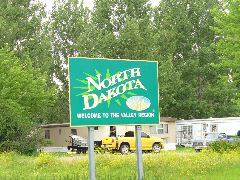
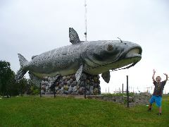
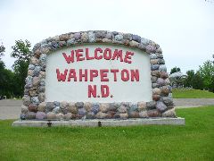
On the banks of the Red River of the North is the city of Wahpeton (pronounced "whuptun"), and a colossal catfish greeted us as we entered North Dakota. This river is unusual, as it flows northward toward Canada and on to the Arctic instead of south to the Gulf of Mexico, an odd quirk of hydrology remaining as a relic of the glaciers that deeply covered this land 12,000 years ago.
 |
 |
 |
| The Red River of the North flows inexorably toward the Arctic | Hello, North Dakota! | Colossal catfish terrorizes small fry |
After departing our new finny friend, we drove south through the campus of the state College of Science, as Richard noted that the little tag in the corner of the windshield was saying now might be a good time to treat Monte's somewhat-new engine to an oil change. The staff at the Jiffy Lube were eager to help, and had our coupe re-lubricated while we toured the shops and buildings of Wahpeton's downtown business district.
 |
 |
 |
| Welcome to "Whuptun" | Monte gets well-earned maintenance | Classic porcelain and neon signs |
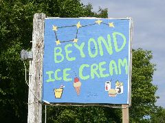
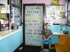
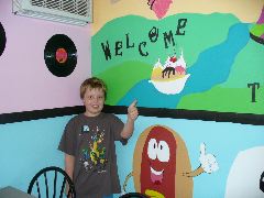
After the oil was topped off, the Taco John's down the street seemed like a good place to grab a to-go dinner, with the staff having some good-natured fun with us as they asked about our travels. But when Wahpeton was a ways behind us and the semi-spicy food was finished, we thought that perhaps a nice cool dessert or three would be the perfect follow-up. And in Wyndmere (that's with a 'whine', not a 'win'), the bright blue sign of Beyond Ice Cream beckoned us into the colorful interior, where the exuberant murals of smiling suns and happy hot dogs brought grins to tired faces. We chanced upon the owner's daughter painting a picnic table by the side of the building, and she relayed to us the family's hopes for soft-serve success, and we wished them all a sweet future as we puttered into the westward sun.
 |
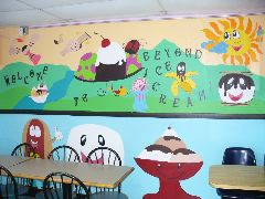 |
| Not just ice cream. BEYOND Ice Cream. | Interior filled with happy decor |
 |
 |
| True wisdom indeed | Two thumbs up! |
The wind had shifted and gained in force as our high-topped vehicle was buffeted by airspeeds near 100 mph, even though the speedometer was reading very legal speeds (even by generous North Dakota standards). We passed the Bobcat factory in Gwinner and waited patiently for a long freight train in Oakes, and continued into Ellendale, where we refueled at the local Cenex station and the very helpful staff sold us personal pizzas and we discussed what places there might be to stay in the area. Making a little leap of faith, we traveled the final 45 miles to Ashley unsure if there would be lodging available at the destination. But it was our good fortune that the Ashley Motel was open and available, and Richard registered amid the flock of mounted ring-neck pheasants reminding visitors of the hunting opportunities in the area. After loading in, Richard wandered the quiet streets at sunset, noting the coffee house also doubled as the office of the local newspaper. And after capturing some scenic snapshots of sunset clouds, we were startled as the 100+ dB tornado siren started its wail of impending doom, even though the immediate skies were rather clear. The moteliers assured us that it was just an annoying periodic test, and we settled in for some north prairie snoozing.
 |
 |
 |
| History of Ashley, in market-wall mural form | Weathered old Ashley buildings | Dakota sunset |
Duncan began his day by grabbing Dad's nicer new laptop (as compared to the beat-up older laptop Richard still often prefers to use), propping it next to his iPad, and updating all of his important Minecraft worlds. We may be thousands of miles from home, but his virtual rectilinear constructions do transport well (and keep him out of trouble on those long days of travel).
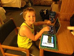 |
| Our little Minecraft multitasker |
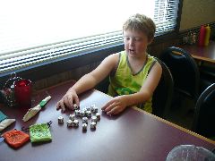
Ambling out of our spacious room at the Ashley Motel, we moseyed over to the Shed Cafe for a filling breakfast with the local folks as the combined might of the Story Cubes resulted in epic tales being spun by the members of the traveling party. Then across the street to the Supervalu market to stock up on pop and other road-trip-appropriate edible items (and although the tub of chocolate marshmallow ice cream looked tempting, we don't think it would travel all that well).
 |
 |
 |
| Shed Cafe - good folks and food | Super-length Story Cube sagas | Are you sure we can't finish this before it melts? |
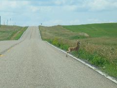
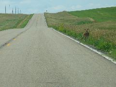
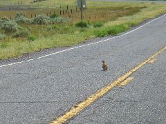
Turning left at the old grain bins, we motored south, as the outline of a Native chief's headdress surrounded the big numeral 3 on the North Dakota state highway sign. And then an "en-deer-ing" sight, as we applied the brakes to yield to a young fawn crossing the road.
 |
 |
 |
| Oh deer. Again. | Avoiding the photogenic lil' fawn | Scoot off the road like a good little deer... |
The boundary separating the Dakotas isn't all that exceptional, except that the grid system of the north state didn't seem quite aligned with its southern neighbor. But a sudden veer left and a hard turn right in the middle of nowhere realigned the routes as the road transmogrified from North Dakota 3 into South Dakota 45.
 |
| Zigging out of North Dakota, zagging into South Dakota |
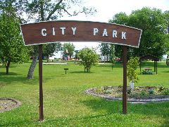
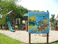
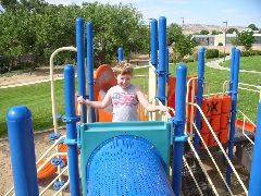
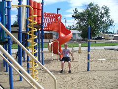
A toodle on state routes 45 and 247 brought us expeditiously into the community of Roscoe. We followed the signs toward the very nice park, and as we arrived we saw a group of kids of varying ages arrive on their bikes (with no adults in sight, and that's just fine with us) commence to play on the "Shipwreck Island" play structures. Duncan joined their imaginative adventures for a while, and they were inquisitively curious about our travels. The weather was picture-perfect - sunny, low 70s, and a light breeze - and made us appreciate how nice can be above the 45th parallel when it's not snowing sideways.
 |
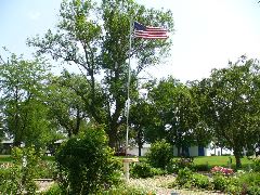 |
| Green city parks are always a welcome sight | Flag flying proudly in the cool breeze |
 |
 |
 |
| Remember: no vandalism. | Nice town, nicer playground | Happy bouncers in a row |
 |
 |
| Duncan approves. | Like father, like son |
After the play time, we reluctantly re-entered the car and turned south again along county roads that were admittedly paved, but had frost-heave undulations that were causing the car to groan in protest (never mind what it was doing to Suzanne's crochet work). Richard picked the route as it provided the most reasonably direct path south to other destinations, but once we reached a less-lumpy state highway, we turned and followed it instead.
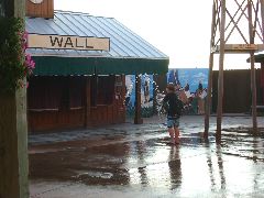
About this time, Suzanne asked: "Are we going to Wall?"
Richard's response: "Wasn't planning on it - we were there just a few years ago in 2010. Thinking on heading straight south toward Nebraska."
After a long pause, a reply from the mom: "But the next time we might be in South Dakota, he'll be too old for some of the activities there."
Another long pause. Duncan breaks the silence: "I want to go to Wall."
Scan maps. Decision point is coming up in... half a mile. Make course correction. Calculate that it'll be a 200-mile course change, and that we won't get there until late afternoon, even with the time zone change.
"We're going to Wall." Happiness all around.
Several miles later, we noted numerous signs by the side of the road announcing that the site was a "waterfowl production area". By the phrasing on the sign, it made it sound like they had hidden factories stamping out baby ducklings in endless rows. But there did seem to be a sufficiency of ducks, especially with all the ponds fed by those recent rains, and as long as they stay away from the windshield they can manufacture all the quackers they want.
And cows, too.
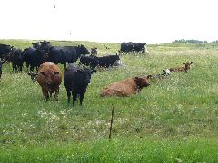 |
| Moo. |
Somewhere in the middle of the state, Richard suddenly began sneezing violently, and felt slightly itchy on his skin. Along with this unease came a feeling of indigestion, as the hearty breakfast from the Shed Cafe was not setting well. Deducing the situation, Richard pulled over and checked his daily pill container, and sure enough the mandatory daily tablets lay undisturbed in their case.
Let's pause here for a minute to explain some of the newly-acquired afflictions of Mr. Moeur. Last fall, after 10 years or so of intermittent heartburn, Richard was diagnosed with both a hiatal hernia (where the esophagus gets kinds bulgy around the diaphragm) and Barrett's Esophagus (are you sure we can't find Mr. Barrett and give it back to him?), characterized by mutations to the cells in the esophageal wall due to acid exposure. And then in January of this year, after a combination of business travel and work stress, he developed hives over much of his body, which took weeks to subside. So every single morning he is supposed to take one proton pump blocker and one long-term antihistamine, and through doing so Richard has somewhat rejoined civilized society. But when he forgets, his body has none-too-subtle ways of reminding him of his error (like today), and he gobbled his pills and hoped the symptoms wouldn't make the Dakotas a heck on earth.
Back to the trip. The fuel gauge on the Monte sometimes is a bit too optimistic, saying that half a tank is 75% and so on. And the needle was now on half, which means less than that. So we remembered our basic rules regarding fuel locations in small prairie towns: Find the grain elevator, and you'll probably find the gas station. And we did indeed find the elevator in Lebanon, as we dodged the double-length trucks lining up to bring in the harvest. And they were so polite: "Sorry, there's no gas anywhere in town. But there is down the road." And we thanked them for their assistance, complimented them on their nice clean facilities, and continued on our way.
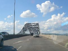
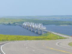
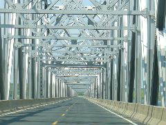
Reaching US 212, we turned west to try a different route. The highway ran straight for many a mile, then curved down toward the lapping broad blue expanse of Lake Oahe and the Missouri River, which bisects much of this state. The shiny silver-sheened truss bridge carried us over the choppy waters, and we climbed out of the valley admiring the views of the grassy hills and distant bays.
 |
 |
 |
| Lake Oahe bisects the state | US 212 spans the lake on a silver bridge | Traveling through the trusses |
Somewhere near Ridgeview, on the Cheyenne River reservation, we saw a set of old yet seemingly-operational gas pumps in front of a repair shop surrounded by acres of expired vehicles in a vast variety of ages, conditions, and dentitude. We pulled up to the pumps and prepared to fill, and that's when we received the news from the Lakotan proprietor that there was no fuel to be dispensed. OK, the car can probably make it farther, but our boy may need to test your plumbing. "No problem!" - and Dunc even received an bonus treat in the form of a cold can of Orange Crush from the cooler inside.
We weren't completely out of gas by the time we reached bustling Eagle Butte, but we were still relieved to be able to fully refuel. Duncan, to his credit, decided to be helpful by attempting to squeegee the latest layer of bugs off the windshield, with Richard offering gentle suggestions and the occasional wipe-off of a missed spot.
 |
 |
| Our helpful little gas-hog | Apprentice attendant scrubs off the bugs |
With clear windows and intentions, we headed south on highway 63 across the Cheyenne River valley, watching the herds of cattle huddle in the corners of the fields to avoid the blustery breezes. And in the middle of absolutely nowhere the plaintive call came from the back seat of a need to address that accumulation of drinks Duncan had enjoyed the past several hours. Here is where Dunc's dad had to instruct on the fine art of the "isolated roadside stop", giving guidance on corrections for elevation, windage, range, and field of fire. Fortunately, privacy wasn't an issue, as the nearest non-family life form was about half a mile away, and much more interested in munching green grass than staring at our attempts at small-scale irrigation.
 |
| The green and scenic Cheyenne River valley |
We puttered into Philip and saw what looked to be an old Amoco station at the corner of route 73 and US 14. We were corrected by the on-duty pump jockey - this had been in fact a Standard station - one of the few allowed to claim that name to preserve the copyright. And although it was now a proud independent under the Coyle family name, the torch-and-oval "Certified Sanitary" decals in the white-tile restrooms still testified to its heritage.
 |
 |
| Topping off in Philip at the former Standard station | Certified Clean. |
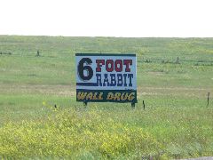
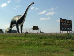
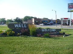
Heading west on highway 14, the family was happy to see a welcome sight every half mile or so - the parade of assorted roadside signs proclaiming the many wonders of Wall Drug Store. We'd visited Wall last in 2010, in the midst of the Great Badlands Bicycle Rack Disaster, and we were hoping this trip would be less stressful. And as we spied the giant green dinosaur standing sentinel over the eastern exit, we cruised into town and set about seeking a place for our evening's sleep.
 |
 |
 |
| Getting closer... | If a giant green dino says "exit", it's best not to argue | Welcome to Wall! |
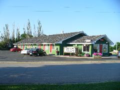
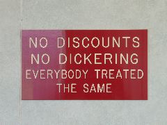
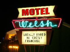
One place that immediately caught our eye was Welsh's Motel, an immaculately-maintained lodging that looked right out of a 1959 postcard. The quoted price and the bright red "no dickering" sign did initially take us aback, but after a bit of conversation a surprising coincidence emerged: Mr. Welsh's nephew had been in the very same high school graduating class as Suzanne back in the early 80s - and suddenly a big country seemed small indeed.
 |
 |
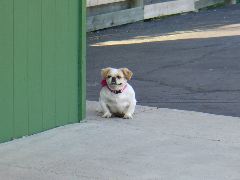 |
| Welsh's is clean, colorful, and inviting | No discount for being a classmate of a nephew...? | One-pup welcoming committee |
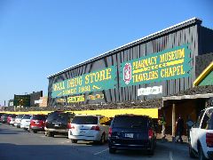
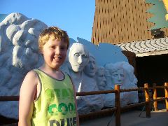
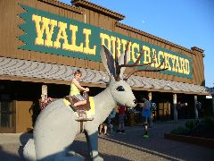
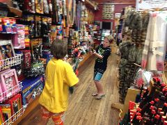
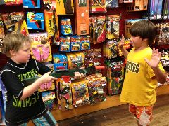
Wall isn't a big town, but it does have a big destination - the legendary tourist mecca of Wall Drug Store. We parked under the large green sign and walked the busy corridors to the big "backyard" full of fun items, such as the conveniently-placed Mount Rushmore, splishy splash pad, irascible tyrannosaur, and especially the giant fiberglass jackalope ready to be ridden by young and young at heart. And if there's one thing Wall Drug has, it's merchandise - not just useful pharmaceuticals but dozens of shops devoted to camping supplies, books, electronics, clothing, leathercraft, and other items. Duncan discovered a bucket that was absolutely guaranteed to contain gemstones, a cute little stuffed jackalope to join our traveling menagerie, and the plethora of toy aisles (and a refreshingly-politically-incorrect selection of play guns) provided arms for a very dynamic but fun battle amid the piles of games and puzzles.
 |
| Yup, we're here. |
 |
 |
 |
| Mount Duncmore, 2014 edition | Taming the Wild Jackalope of the Upper Midwest | "He probably won't eat you. Maybe." |
 |
 |
 |
| Drenched Duncan on the wacky splash pad | Shootout in the Tourist Trap Corral | "Reach For The Souvenirs!" |
In our previous visits, Wall Drug was noted to stay open until 10 PM to serve late-arriving travelers. However, even though the "official" closing time was announced to be 9 PM, we found ourselves being herded into more and more confined areas, noting with dismay the premature closing of the ice cream counter and food service. And at 9 sharp, we were tossed out on the street and returning to the motel, where Duncan could snuggle with his new jackalope and the parents could get some neon-accented rest.
 |
| Buzzing bright neon back at the motel |
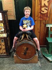
After regaining our consciousness and composure at Welsh's, we wandered back to Wall Drug to complete our pilgrimage. Richard found a ingenious folding pocket-tool that seemed worth exactly the $3 he paid for it, and Suzanne obtained several colorful cords for her iPhone. Duncan was very enamored with an array of mounted jackalopes, and asked the saleslady if they were real. She apparently hadn't had a good morning, and said "No, they're not real." Duncan responded that if they weren't real, then what were they doing here? But Richard wasn't helping the situation much - he was trying to look on the other side of the display to see if there were a bunch of corresponding fuzzy tails on that side.
 |
 |
| Over a barrel and enjoying it | A Dunc-a-lope sighting! |
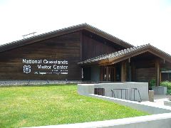
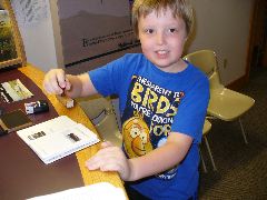
After watching the fountain staff make up a batch of fresh ice cream (and sampling some ourselves), we headed down the street a block or so to visit another site of interest - a USDA visitor center for all those National Grasslands we'd traversed from New Mexico to Minnesota. We stamped our National Parks Passports (yeah, it's a different agency, but they still reciprocate on the stamping stuff), and learned about the complex prairie ecosystems and their furry fuzzy denizens.
 |
 |
| A grass-iously wecoming visitor center | Stamping the grass-port |
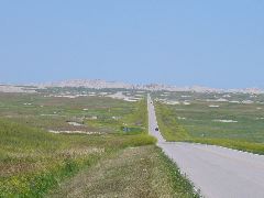
Time to wooble out of Wall. And south would our preferred direction; however, the eroded geologic roadblock of the Dakota Badlands was smack-dab in our way (and the last time we went through there, it cost us a favorite bike). So we detoured west on I-90, and then on quiet old US highway 14 and 16, which made for a much more enjoyable (but whoopsy hilly) ride than the superslab. And every so often, the occasional prairie dog would dart its chubby little body across the road, so we were reasonably wary of unexpected situations.
Or at least that's what we thought. As we neared a roadside house, a playful canine suddenly appeared in the tall grass by the pavement edge. The dog hesitated for a second, and then darted across the highway before we could even begin to react. Brakes squealed, tires slewed, a black and white blur across our path, and...
THUMP.
We rolled for several hundred feet farther before we could even compose our senses. Finally at a stop and trying to settle down the adrenaline levels, we turned around slowly to see what carnage our bumper had wrought. But there was nothing to be seen - just open road. We looked again just in case the carcass had been thrown into the weeds, and then... up on the hill by the house, was one black and white dog, panting happily with an expression as goofy as can be and no apparent damage, seemingly saying to us "OK, that was a bit close."
Whew.
After a brief stop in New Underwood for personal pizzas and malt cups (which seem to have become the official food groups of this year's trip - not that we're complaining), we turned south to double back toward our original heading. We entered the Pine Ridge Oglala Reservation as we left the last vestiges of Badlands behind us, and stopped briefly at the community market for a brief break, where the people we met were exceptionally friendly to us.
 |
 |
| The vast vistas of lands of badness | Yep, they're bad lands. |
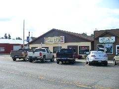
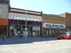
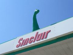
After crossing the boundary into Nebraska (seemingly marked only by an unexpectedly large number of tumbledown package liquor stores), we continued south into the Sand Hills, enjoying the higher altitude and tree-lined scenes. Rushville didn't seem entirely rushed, and the quiet downtown was a good spot for a respite from the day's driving. Behind the venerable brick exterior of Pudelko's Department Store we found quite a few bargains and unique items, with some merchandise still arranged in displays reminiscent of our 1970s childhoods (we like that). Then a quick fill-up at the Sinclair station on US highway 20, with the roof-mounted brontosaurus keeping an alert green eye on the travelers below, and southward we continued into the rolling prairie wind.
 |
 |
| Pudelko's in Rushville - a little something for everyone | Drive-offs will be trampled. |
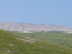
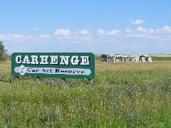
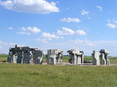
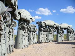
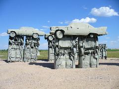
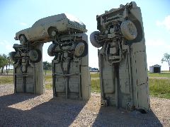
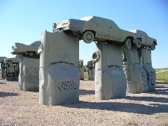
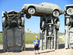
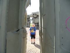
We've visited many locations around the United states that are fun, interesting, wacky, or bizarre, but only a few are truly eligible for elevation into the lofty realm of Road Trip Must-Sees. And one of these legendary destinations just happens to be found near fields of corn in the expanses of western Nebraska. In the early 1980s, a family decided to recreate a famous site from prehistoric England using vehicular metal from Detroit, and so it came to pass that Carhenge was born. In the intervening years, the site has been condemned as "junk" and praised as "high art", but most of all it's simply an exemplary manifestation of the American urge to make something unique and interesting and hope people show up and appreciate it. And now Carhenge has achieved fame far beyond the nearby plains, and attracts visitors from around the world to its sheet-metal mysteries. And as Richard noted, enough time has passed that several of the cars comprising the plinths and capstones are notable in their own right, as you just don't see that many Gremlins and Vegas anymore, let alone as part of an oddball tourist attraction.
 |
 |
 |
| Carhenge. At last. | The circle of cars, closely corresponding to its English counterpart | The cars curve in the cornfields |
 |
 |
 |
| Decades of Detroit products arranged in a millennia-old pattern | Vega station wagon holds an exalted position | Carefully-arranged, not seemingly-strewn |
 |
 |
 |
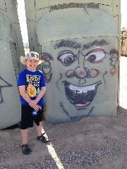
| A pair of Gremlins | Others have added their inscriptions (no, Duncan didn't do this one....) | Dunc-henge |
 |
 |
 |
| After long service, now gone belly-up | The Car Art Reserve looms above Carhenge | Being a cool squirt on a warm day |
 |
 |
 |
| The dinosaur does look like it needs feeding | Really big steel-head salmon | Flowers of fans |
 |
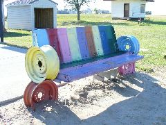 |
| The aura of the place begins to affect us | Bright benches fabricated from old tailgates |
 |
 |
| Smooshing some metal to commemorate our visit | Explaining the mysteries |
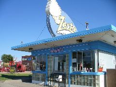
Hiking around Carhenge had made us hungry, and we steered south toward Alliance in search of good feeding. And along the highway just before the railroad underpass we saw the unmistakable twisty-cone outline of a Zesto stand, and zoomed in for some tasty grub. The gleeful gals of Madeline's Zesto whipped up some juicy burgers and chicken for our devouring delight as the freight trains rumbled behind the restaurant, and we continued on our way contented with our meal.
 |
 |
| Zesto to go! | A fine Nebraska rest area |
Farther south, we crossed the North Platte River and continued on US 385, with the late-day sun illuminating our path. That same sun was drooping low by the time we arrived at Sidney, so we discarded our plans of a Colorado overnight and drove the century-old Lincoln Highway through town until we spied the Sidney Motor Lodge, a late-1940s property with curved-brick decor, a charming ambiance, and best of all - reasonable prices. We discovered through a chat with the owner that he had just purchased the place, and was planning on implementing some upgrades to improve traveler comfort. But we found the ceiling fans and original wood accents quite to our liking just the way they were, and we rested soundly, completely undisturbed by the Union Pacific main line tracks just across the street.
 |
 |
 |
| Settling down at the Sidney Motor Lodge | Interesting architectural touches in the motel's design | Motel receives the Duncan seal of approval |
Had a nice morning in the Motor Lodge watching cartoons and heating up semi-identifiable leftovers for breakfast. Only incident of note was when Richard slightly misjudged the elevation and configuration of Monte's trunk lid and tore a teeny chunk out of the back of his ear, but the bleeding had mostly stopped by the time we were ready to go and the drips matched the car's paint finish anyway. :)
Nebraska state route 19 plummets south from Sidney the few miles to the Colorado border, then changes numbers as it continues down to intercept US 138 on the outskirts of Sterling. We hadn't put in a huge amount of miles yet, but those leftovers had long left us in the metabolic cycle, and a big hearty sit-down lunch seemed like a very good idea. But where?
In downtown Sterling US 138 terminates, merging into our old friend US 6. But the FOOD service signs pointed westward on route 14, which turned out to be a stretched-out nest of fast food, with no cafes or diners in sight. Suzanne whipped out her iPhone, made a query for "family cafe Sterling" and requested an immediate 180 in the course, as a highly-regarded cafe lay behind us on the other side of downtown.
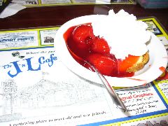
And the J & L Cafe more than met our expectations. The joint was a bit busy due to its popularity, but we were seated and ordered, and in due time Duncan was digging into a big bowl of spaghetti, Suzanne was savoring breakfast number 2, and Richard was gazing down at a big juicy steak and baked potato. Yum to the third power - and then the remarkably inexpensive shortcake was a delectable follow-up.
 |
 |
| J&L Cafe - nice place to chow down | Mmmmm. Strawberry shortcake. |
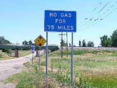
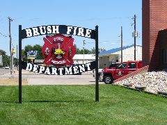
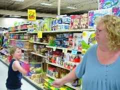
We sidled out of sterling on the diagonal path of US 6, following its path through the verdant valley of the South Platte River. The day was getting warm as we bumbled into Brush, and a sign saying NO GAS NEXT 75 MILES did direct our attention to the fuel needle flirting with "E". After finding a combination supermarket and fueling station, we ambled up the aisles. However, for some reason Duncan had somehow shifted into Crazy Cranky Mode, which then cascaded the mama into grumbly disgruntlement. First aid was applied in the form of M&Ms and Little Debbies, and the gang was at least in "kinda OK" mode as we re-boarded the vehicle in anticipation of many many long straight flat miles.
 |
 |
 |
| OK, maybe $3.70 per gallon isn't all that bad | I think they can handle brush fires... | Swashbuckling flyswatters |
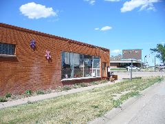
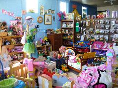
Most people have an impression of Colorado as being completely comprised of scenic peaks and sparkling streams. But much of the eastern part of the state is very flat and sparsely populated farmland with wide-open highways, and that was the stretch we would traverse today. Last Chance gave no chance for facilities - no gas, no food, no lodging, and no restrooms. Many miles of unimpeded driving later, we loped into Limon and noted at the intersection with US 24 and 40 a brick building with a very interesting name - and likely a bathroom inside, to boot. Dragobu Den is another one of those places we love to discover in our travels - eclectic, fun, jam-packed with odd items - and air-conditioned as a bonus. Although we easily resisted the urge to purchase the fighting knives, cocktail dresses, and playpen accessories, we did buy two books for Duncan's burgeoning library.
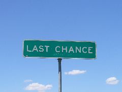 |
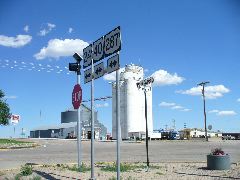 |
| No chance. | Many highways meet in Limon |
 |
 |
 |
| Dragobu Den - a fun stop in Limon | Many interesting items. | Almost too many... |
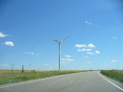
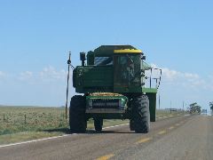
More long miles through nearly-desolate fields and pastures. Moments and vignettes: rows upon rows of black-eyed susans waving in the prairie wind. Dozens of small birds dive-bombing bugs in our path and pulling up just in time to avoid becoming a feathery decoration on the front of our cartop carrier. Creaky metal windmills drawing precious water from deep aquifers to nourish the cattle and crops. Rows of much larger modern windmills towering high in the air with the tips of their blades whooshing through the sky. Ranch houses dotting the roadside many miles apart, some with sturdy swingsets that looked like perhaps the kids who originally played on them now had kids of their own. The whumpety-bump of the Monte's suspension bottoming out on the frost-heaved highway. Mega-sized tractors chugging slowly up the road. And far off on the western horizon were the merest gray hints of the profile of the rugged Rocky Mountains.
 |
 |
| Newer windmills whoosh in the prairie breeze | Big load comin' thru |
We'd last visited Ordway on our Big 2007 Road Trip, when Duncan was a wee child and the Truckasaurus was tugging an overloaded trailer homeward from Michigan. Today, we stopped by the gas station in the middle of town for a fill-up, and found out it was full-service only - for the simple reason that the old pumps read only in cents, and needed a 10 x multiplier for the actual cost (dang.) We tried to strike up a conversation with the Aussie (or Kiwi)-accented lady pumping the fuel, but she seemed resistant to socialization.
 |
| Old-style gas station in Ordway |
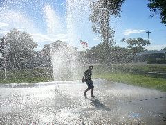
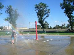
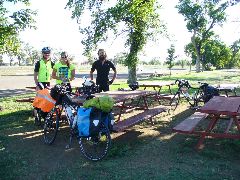
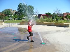
But Duncan had seen the jets of water emanating from the splash pad at the park by the old hotel, and knew what he really wanted to do for the next few minutes. Releasing the child for some high-pressure fun, we then saw several people also congregating in the park - and then we saw the bicycles. Ordway is a waypoint on Adventure Cycling Association's Trans-America Bicycle Route (soon to be designated coast-to-coast as USBR 76), and several transcontinental cyclists were resting under the trees or splashing in the jets. Richard spotted a "Tour de Scottsdale" jersey on a friendly young lady, and it turned out the couple (Tyler and Annie) live in the Valley, but were currently having a great time pedaling across the US. We swapped stories of tours old and knew, and Richard mentioned how the development of the US Bicycle Route System might bring more travelers to places like Ordway and beyond. Some other riders arrived from the east bearing grim stories of horseflies and headwinds, but were soon relaxed and chatting in the group. Also about this time, damselflies began to appear on the lawn, making what looked like an iridescent blue carpet below the benches and bicycles. It took a few gentle reminders from Suzanne to tear Mr. Moeur away from the group (with Duncan needing even more persuasion than that), and we bade them safe travels as we resumed ours (but first a stop for Moon Pies at the local market, of course).
 |
 |
 |
| Oh so wet fun in Ordway | Playing under the rainbow | Cross-country cyclists from our home state |
We've spoken of prairie dogs frequently in this year's log, and it's hard to get tired of their zany antics. But today for some reason a passel of the little chubbers got in their tiny minds that it'd be fun to dart out right in front of the car, just to see what would happen next. And we're sure that their friends who popped their heads out of the burrows and over the grass thought it was hilarious that our big red car looked so ungainly in swerving to avoid their furry flanks. But the flattened remains of a few of their compatriots did show that there might be steep price to pay for such a pastime.
US 350 roughly follows the route of the Santa Fe Trail as it traverses from near Rocky Ford down to Trinidad, and the old wooden bridge rails and the bumpy ride made us think that this highway wasn't all that much younger than the pioneer route. The sun was beginning to descend behind the nearing profile of the Rockies as approaching thunderstorms bracketed our vehicle and lit up our interior, and we explained to Duncan (whose iPad had run out of power, so he had to rejoin the real world) how to tell the intensity by the color of the rain and the distance by the delay between the flash of the lightning bolt and the boom of the thunder.
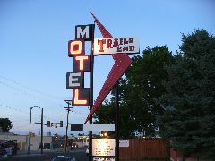
As we entered Trinidad on the old road, a red neon arrow pointed the way into the Trails End Motel, and we took the hint to park beside the rough-hewn rooms. The proprietor seemed willing to negotiate a very fair price, and we loaded in, enjoying the high-country coolness and seeing the lighted sign proudly displaying the city's name glowing across the valley.
 |
| The end of today's trail |
And as Richard finally began thinking he'd relax and unwind in our mountain rest, two other voices reminded him that we hadn't had dinner yet, and so Dad performed his food-hunting duties in a manner befitting his ancestors by pulling up to the menu board at Sonic and rattling off the list of desired items (including fresh tater tots and a strawberry shake, of course). But after all was fed and done, we sprawled on the beds and snoozed away, knowing deep down that only a couple of road-trippin' days remained.
 |
| A bright sign as night falls |
Two more days to go. Got up and going as neuron-depleting Disney Channel movies flickered on the motel room's TV screen, and then down the stairs and out the door. Suzanne was hankerin' for a McDonalds McMuffin for breakfast, but Duncan saw the city park and multi-story play structure just across the creek from McDs and asked if we could pleasepleaseplease stop there for a few minutes? And, as often happens on these trips, both wife and son got just what they asked for, and Duncan bounded up the stairs, down the slide, and around on the whoppsydoodlesomethingwedontreallyknowthenameofbutisstillfun. But we hadn't planned on the adjacent splash pad (in fact, we didn't even remember it from our previous visit to this park seven years ago), and a thoroughly soggy but utterly elated child was eventually wrangled into the back seat (fortunately, both he and most items around him are water-resistant).
 |
 |
 |
| Many levels of fun | The Joy of Lopsided Spinning | Another day, another splash pad |
Interstate 25 southbound from Trinidad ascends the Raton Pass, and the grade grew somewhat steep as we approached the New Mexico border. But aided by cool mountain air, Monte rumbled over the summit and across our next-to-last state line, and we descended into the motel-studded downtown of Raton in good shape. Several miles south of here, US 64 veers west by south from the freeway, and we exited to see where this highway might lead. By our reckoning, US 64 is the only east-west corridor across New Mexico we hadn't yet explored, and today seemed like a fine day to do so. The prairies petered out at the foot of the Sangre de Cristo mountain range near Cimarron, and tall peaks stood in our path.
 |
| The plains give way to the peaks |
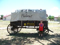
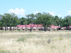
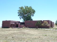
So let's take a short detour. A few miles south of town is one of the most important places in the Scouting movement in North America - the hundreds of rugged square-knotted square miles of the Philmont Scout Ranch. Someday, Duncan might come here for hiking or high adventure, or his parents might arrive for a training course, so we thought it might behoove us to take a look around. The path of the historic Santa Fe Trail traverses directly in front of the visitors center and museum, and the displays within chronicled the growth of this facility, noting with pride that the one millionth Scout from across the nation was estimated to have arrived only a couple days prior to us showing up.
 |
 |
 |
| In a few years, you might be camping here! | This place is in-tents. | Informative Scouting museum on the Philmont property |
Doing our best at being prepared, we rejoined US 64 and turned west into the heart of the southern Rockies. The speed limit dropped to 25 as the road twisted and turned around the sheer cliffs and rushing rapids, and we realized that today might take longer than expected - but in exchange for being rewarded with green mountain vistas and nice cool breezes. Wet ones, too, as near Angel Fire the heavens opened up upon us, and we said silent thanks for the watertightness of the cartop carrier as we splooshed along the striped lines.
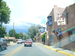
We'd heard many tales of Taos, with descriptions ranging from rustic to ritzy, from ordinary to ostentatious. But as we drove in, it struck us as all of the above - sort of like, as we said, "Sedona, only with trailer parks". The plaza was teeming with tourists and expensive wares, so we looped through and continued on to the local Allsup's station, where the beef and bean burrito (the official road trip food of this state?) fit our demographic well - good taste, not too hot, and at a very reasonable price.
 |
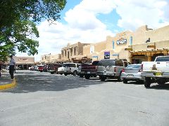 |
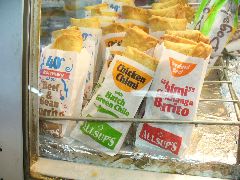 |
| Adobe overload | The pricey plaza of Taos | Our kind of fine New Mexico cuisine |
Only a few miles west of Taos US 64 leaps across the chasm of the Rio Grande on a sweeping high deck arch bridge, and at this scenic spot congregate a passel of talented artisans and oddly-painted food trucks, along with more tourists than you can shake a rattlesnake at. Duncan was interested in the bone-handled knives, and Suzanne was taken by a finely-woven shawl, but we kept our splurges to a minimum, except for the yummy ice cream served up from the big ol' bus.
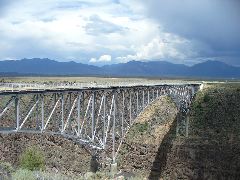 |
 |
| An award-winning arch carries US 64 over the gorge | Now they tell us... |
 |
 |
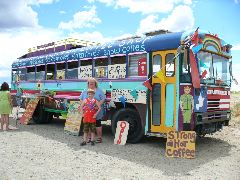 |
| High fives from the vendors | A weaver named Weaver | Not just ice cream - ice cream from a solar-powered bus! |
We continued west across the high plateaus and verdant meadows, with the GPS noting that we'd ascended above 10,000 feet (no oxygen mask will drop down in front of you)! In Tierra Amarilla, we chose to take a short break at a store whose towering sign advertised nearly any creation devised by mankind, and within its interior we did find almost anything - hardware, hunting, fishing, food, toys, and other sundries dating from the 1960s to earlier this week. Richard unearthed a present for Truckasaurus back home in Phoenix, and we kept rolling as 64 curved northward toward the next set of towns.
 |
 |
 |
| "Roger, climbing through 10,000." | A very useful place | OK, what don't they sell? |
There are several historic and scenic railways still in operation across the United States, keeping old tracks in use to show new generations how trains helped build our nation and can provide access to scenic splendor. One of those is the Cumbres and Toltec, whose rails still to this day carry steam locomotives and wooden excursion cars between New Mexico and Colorado. Although we didn't have time to take a ride in the trains, we did get to see the tooting and hooting steam engines as they puffed and hissed in preparation for another run.
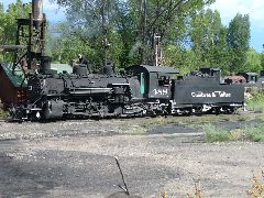 |
| The locomotives toot in Chama |
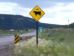
We made a note to that it might be fun to return to this part of this state, and continued west to Dulce, on the Jicarilla Apache reservation. And although we didn't encounter any bovine-abducting extraterrestrials, we did behold a uncommon sight - a herd of bison snuffling and grazing in their nonchalantly majestic manner.
 |
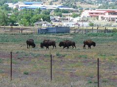 |
| Watch for elk. And alien abductions. | Where the buffalo roam |
OK, you might be tired of all the times we've mentioned prairie dogs in this year's saga. But indulge the little guys one more time. West of Dulce and south of Navajo Lake, New Mexico DOT was performing some needed repaving on US 64. We saw the advance warning signs for the flagging station, reduced our speed... and then we saw a chubby fuzzy prairie dog standing on his hind legs right in the middle of the roadway, which brought us to a stop much faster than any stop/slow paddle. Given that he wasn't wearing a little prairie-dog-sized hard hat or ANSI Class II vest, we weren't entirely sure if the little guy had completed his ATSSA training or was even on the contractor's payroll. but we waited until he yipped his OK and scurried to the shoulder before we proceeded with caution.
 |
| Not pictured: a really tiny STOP/SLOW paddle. |
And a short distance ahead was a slightly-taller human with a vest, radio, and paddle, and we waited patiently, and patiently (and maybe not so patiently) to proceed. Eventually the pilot truck appeared to escort us through the bustling asphalt-scented jobsite. Turned out to be a long project (which explained the wait) - milling, scarifying, in-place mixing, laydown, and rolling were occurring in the afternoon sunshine as even more prairie dogs watched from the sidelines.
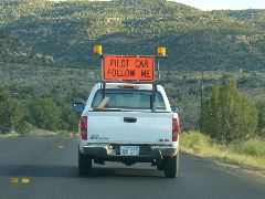 |
| At least we're moving again... |
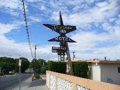
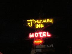
For most of the trip since Duluth, we'd been on roadways we'd never traveled before. But in Bloomfield as we crossed US 550, we rejoined familiar roads from past journeys, and began to think about lodging options as we approached Farmington. We knew there wouldn't be much available or affordable for hundreds of miles west or south, so we investigated an enclave of older motels on the west side of town. The Sage Motel, where we'd spent a grease-spattered evening on the 2003 Road Trip, had no rooms large enough for the clan, so we went next door to the Journey Inn to see what they had available. Although the exterior didn't look too promising, the two large beds, hidey hole perfect for a 9-year-old, and the full-size refrigerator sold us on the spot - and it also helped that the price was also very much in our range.
 |
 |
| Economical lodging options - with Color TV! | Complete with kid-sized cubbyholes |
Wait - did we have dinner? No, and I even think we forgot about lunch. Fortunately, Chef Bernie's restaurant was literally around the corner, and as we passed under the neon-bedecked sign and exterior into the linoleum-and-Naugahyde interior, it was like stepping into a time warp back to the early 70s - and to our wallet's delight the prices on the menu looked little-changed from that era as well. Duncan devoured his $1.75 hamburger plate while Dad worked on a $6.95 steak, and Mom tucked into an overflowing $6 plate of Mexican favorites. The only hiccup to the meal was when a misunderstanding on the drink refill policy led to a meeting with Chef Bernie himself, but old favorites from the table-mounted jukebox and friendly words from the staff (and those low numbers on the check) mended things nicely - and the big pile of sopapillas and honey that followed us out the door was another item in the plus column.
 |
 |
 |
| A grand sign of inexpensive eating | Zigzag neon, googi-esque architecture, low prices | Complete with woodgrain jukebox at every table |
And after our most hearty meal and a short journey back to the Journey, Richard busied himself with catching up on paperwork as Suzanne watched brain-warping summer reruns, Dunc repeatedly disappeared into his happy little hiding spot, and the neon quietly buzzed outside.
 |
| Good night, Farmington |
Let's all wish Richard a happy 51st birthday. (yay.) Now before anyone thinks that it's some sort of plan or conspiracy to have his birthday fall on the final day of a Big Road Trip for the second year in a row, let us assure you that is simply a coincidence of timing caused by the scheduling of the NCUTCD meeting and associated travel, and not an excuse to buy piles of cheesy souvenirs as "presents".
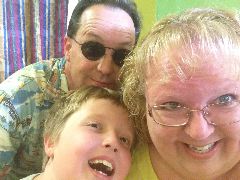
Now that that's out of the way, on with the trip. One thing we'd noted as we'd flipped back and forth last night between the motel and Chef Bernie's was a small park next to the row of motels, and Duncan and his feeling-awful-older dad investigated while Suz stayed back in the room to enjoy blissful calm, er, finish packing. The boys waved to the local residents and cavorted on the ladders and springs, deftly avoiding the thousands of small brown cylindrical organic objects littering the grass (which turned out to be byproducts of soil aeration, not canine dyspepsia, much to our relief). Then back to the room for one last search through the squeaky drawers and big fridge, a goofy smile for a silly 'selfie', and we were on our way.
 |
 |
 |
| Squeezing in some play on the final day | Farmington can be fun | What a scary goofy bunch to take on a trip |
New Mexico highway 371 travels directly south out of Farmington, providing a very low-traffic route across the magnificent desolation of the arid lands of northwest New Mexico. It's over a hundred miles from US 64 to Interstate 40, and our companions for much of the journey were cloud-dappled skies, rows of wooden power poles marching to the far horizon, and a fully-laden tanker truck nearly matching our speed about half a mile in front of our long red hood.
 |
| Long and desolate stretches of New Mexico highway 371 |
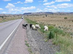
And the sheep, of course.
Wait, what sheep? As we approached Crownpoint, the ever-alert driver noted what looked to be seven oddly-covered bushes on the shoulder. Only they were moving. Randomly. And eating the real brush. We didn't need a "We Brake For Sheep" bumper sticker as we swiftly decelerated, and we pulled off onto the shoulder to view these cute lanolin-soaked trespassers on the public right of way. They paid us little mind as they made their munching way up to our car, then suddenly scampered across the highway to sample the greens on the other side (good thing there wasn't much traffic, or it would've been mutton on the bumper).
 |
| Don't hit the sheep. That would be baaaaad. |
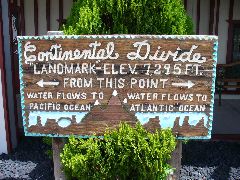
Arriving at the freeway, we became Thoreau traffic as we zipped through that teeny town and merged into the high-speed lanes. But recall that it had been a while since we'd seen plumbing-equipped civilization, so we promptly exited again at the next place with facilities, whose name turned out to have a lot to do with bi-directional water flow. For we were at the Continental Divide, where legend holds that the water on the west side flows to the broad Pacific, and waters to the east end up in the Atlantic via the Gulf of Mexico - whereas the reality is nearly all of it either percolates into the ground or evaporates before it makes it a few hundred feet. We ebbed into the Continental Divide Trading Post, which exhibited a refreshingly different array of wares than the typical tourist trap (but not too different - that wouldn't be fun). Duncan really wanted a piece of copper and affordable amethyst, and Suzanne found a capable Route 66-print purse to replace her aging one, and Richard selected the first of his "birthday" gifts - a wild-print bandana.
 |
| To be honest, most of it just evaporates |
While we were shopping, an older man who had been conversing with the proprietors turned to Richard and said, "That's a 2007 shirt, isn't it?" It turns out he was referring to the limited-edition Route 66-print shirt that Richard was wearing that day, manufactured in the United States by High Seas Trading Company. Over the years, Richard has amassed quite a collection of these scenic and long-wearing shirts, and they comprise nearly 100% of his upper apparel on these Big Road Trips. Well, it turns out the gentleman we'd met is the regional sales representative for these shirts, and the two spent several minutes comparing notes and stories about the 2,400-mile long small town that is Historic 66.
And although the trading post had many things, it didn't have lunch, and so we proceeded westward onto the superhighway to see what lay ahead. And in only a few miles, the distinctive yellow sign of a Denny's appeared outside a truck stop near a silver-tanked oil refinery, and exited again we did for fill our feeding needs. A bonus is that Denny's will provide a free breakfast to anyone brave enough to prove it's their birthday, and Richard did just the opposite of usual by having that meal in the afternoon (whereas he's usually a "lunch at 7 AM" kind of guy). The rest of the gang was happy with their selections and the service, and we motored away full and content.
 |
 |
| Birthday meal time! | Mmmmm. Breakfast for lunch. |
 |
 |
| It did say "please". | The vistas of western New Mexico |
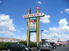
OK, it's mid-afternoon, and we're not even out of New Mexico yet. But Richard remembered that the Monte's mileage log had mysteriously disappeared back in Minnesota, and that there was a store on Route 66 in Gallup that just might have a replacement. And so it came to pass that he invoked the "It's My Birthday So We Go Where I Want" card (not that Suzanne was complaining, given her affinity for things of writing), we parked in the shadow of the giant yellow pencils of Butler's Office Supply, and we loaded a cart with colorful clipboards, ingenious index cards, and other odd items. Butler's prices are competitive with any big-box joint, and the service and eclectic selection is always good for some scribbly fun.
 |
| At The Sign Of The Enormous Implements Of Writing |
After boxing up our Butler's loot, we toodled along the tastefully tacky stretch of 66 through Gallup, stopping briefly under the historic facade of the Hotel El Rancho to see if Armand was available (he was sadly indisposed), and then a fill-up at Allsups and onto the highway again, approaching the rugged cliffs of red rocks demarcating the border with Arizona. We didn't stop this time at the state line, instead opting to make up some time on the superslab as black storm clouds billowed in the rear view and the green signs and round hogans of Lupton, Houck, and Sanders whizzed in and out of view. Once we'd put enough distance between us and the rumbling behind us, we exited just east of Holbrook at the roomy Hopi Travel Center for a quick break (after paying our ear-rubbing respects to the little black kittycat at the front door, of course). There's a mineral and souvenir store here we hadn't visited before, complete with a big brown Richard-designed Arizona-style Historic US 66 sign in the window. Duncan discovered the perfect blue-stone bola tie to wear at all his future formal occasions, plus some iridescent agates too.
 |
 |
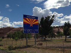
| Back in the ol' home state | There's Dad's sign design again... |
Only a few short miles west is the town of Holbrook where we'd stayed way back on Day 1, only this weekend the entire place was celebrating their annual Wild West Days, with teeming crowds, busy booths and mounds of cooked meats out and around the county courthouse and adjacent streets. And even though it seemed just like one of those events that would create a whole bunch of great additional Big Road Trip stories and memories, we looked at the lack of parking, and hot asphalt outside the car and the sore legs and droopy eyes within the vehicle, and chose to just continue west, knowing that the crowds attending sure looked like they were having a great time.
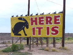
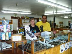
But we still might be in the mood for some fun that didn't involve crowds or long walks, especially if it includes old friends. We brought the red car to a stop by the bright yellow bunny-infested HERE IT IS sign at the Jack Rabbit Trading Post, and felt the breeze of the evaporative cooler as we strolled in the screen door. Tony and Cindy Jacquez gave us a most friendly welcome, as Duncan scanned the shelves for items of interest ("Dad, did you know that the figure in the emergency playset is the very same as my 'Captain Jack' - oh, ice cream!") as the other couples caught up on doings and goings-on near and far. Richard saw that there was one Hot Wheels bola tie remaining behind the counter, and thought that might look great with his Scout leader uniform come Pinewood Derby time next spring. We completed our purchases just before the creeping storm knocked out the power, and we departed as the Jacquezs' bright smiles peered from a temporarily-dark store.
 |
 |
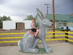 |
| And here we are. Again. | So great to see Cindy and Tony | Obligi-bunny photo, 2014 edition |
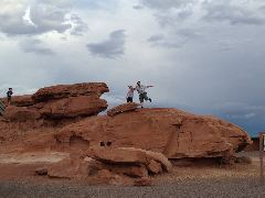
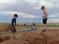
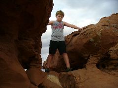
Over the past several Big Road Trips, we've noted that Duncan very much enjoys climbing the red rocks of the Meteor Crater Rest Area. So, we stopped there once again to let him clamber the crevasses. This time, he met up with another boy his age with a more-athletic bent, who then dared, er, suggested that Dunc jump across high rocks above precipitous drop-offs. Richard overheard the conversation, did some quick calculations as to the capabilities of his boy and the availability of trauma treatment in the area, and said... nothing - and the twosome did fine with no apparent injuries (and Duncan learned a bit more about what he could, and couldn't, and shouldn't do - most importantly, on his own).
 |
 |
 |
| Goofing on the rugged red rocks | New friends, new dares | So should I leap or not? |
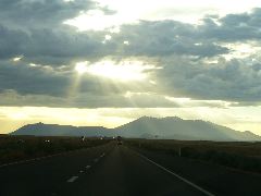
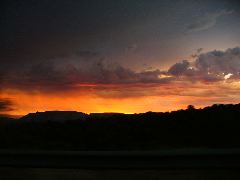
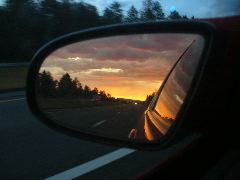
As we approached the peaks looming over Flagstaff, that storm system that had been chasing us since western New Mexico finally caught up, creating some impressive views of sun streaming through clouds. But as we looped south along I-17 for the final 130 miles, the bands of weather belted us with gusty winds and splattering showers. The overcast relented for just enough time to see a magnificent sunset as we descended into the Verde Valley, and then a brief stop for fast food (made more interesting as we'd wandered directly into a manhunt for an escaped convict) and a relatively-uneventful drive along the wiggly freeway down to the semi-sprawl of the Valley. One final fillup to balance the books, over the little hill, and a creaky bumpetybump into the driveway at 10:12 PM to close out our 23-day mission. The overgrown puppies were overjoyed to sniff us again (and the cats might just have even looked pleased we had returned, but we're not sure), and the housesitter turned a somewhat-intact house and a well-worn set of keys back into our custody. Hump a few items in, say "aw heck - we'll do the rest later", and slump into the familiar chairs of our "home motel", feeling very happy we had such a great trip in 2014.
 |
 |
 |
| Shafts of light stream down on the Peaks | Sunset as we plummet on I-17 | Goodbye, road trip! |
 |
| We home. |
See you in 2015!
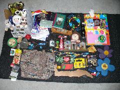 |
| So where do we put all this stuff? |
 Back to The Big 2014 Road Trip Page
 Back to Our Big Road Trips Page
Latest Historical Revisionism 30 December 2014
Scripting: Richard C. Moeur Richard C. Moeur's Home Page